
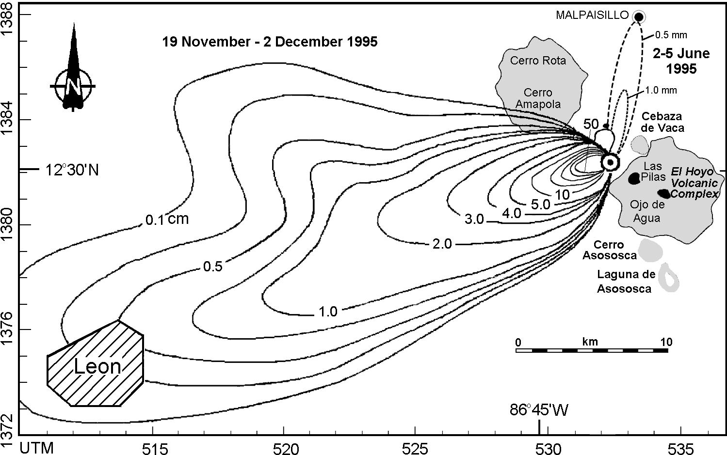
This isopach map at: http://www.geo.mtu.edu/volcanoes/central_america/nicaragua/cerro_negro/gvn/images/2012neg4.jpg shows ashfall distribution over a geographic area in a given time period. An isopach map is a contour map showing the distribution and thickness of some substance, such as thickness of a stratigraphic layer, or distribution/density of ashfall.
No comments:
Post a Comment